


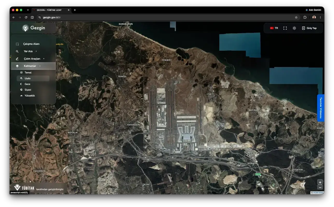
Gezgin Portal, developed by TÜBİTAK UZAY and serving as Türkiye's first national satellite imagery portal since 2014, has been relaunched with a comprehensive overhaul. The renewed portal is open to public institutions, municipalities, universities, researchers and the private sector, with its new user-friendly interface, secure infrastructure provided through e-Government integration, and GÖKTÜRK-2 imagery offered in addition to the RASAT archive.
What Is Gezgin Portal?
Gezgin is a free satellite imagery search and download platform developed by TÜBİTAK UZAY. Launched in 2014 as Türkiye's first national satellite imagery portal, the system can be used by citizens as well as public institutions, municipalities, universities, researchers, postgraduate students and the private sector.
Which Satellites' Imagery Does Gezgin Portal Offer?
The portal offers users imagery from two national satellites. RASAT was launched in 2011 as Türkiye's first indigenous and national Earth observation satellite and served for 11 years. All of the satellite's imagery remains permanently accessible in the archive. GÖKTÜRK-2, meanwhile, has been in service since 2012 as Türkiye's first indigenous and national intelligence satellite. Still active, the satellite provides regular imaging of Türkiye and its surroundings. TÜBİTAK UZAY also announced that the portal will soon be enriched with new satellite imagery.
How Is It Used?
Access to Gezgin Portal operates through a fairly simple flow. Users first visit gezgin.gov.tr, then log in via e-Government and select their regions to download imagery. Searches can be carried out in three different ways: searching by place name, searching by selecting on a map, and searching by point, line or polygon.
Imagery can be added to a basket and downloaded in bulk. After adding their selected images to the basket, users can track the number of images via the basket icon at the top. With the "Download Basket" option, a single order is created for all selections, and the images are provided in a single ZIP package along with the relevant files.
In Which Fields Is It Used?
Satellite imagery obtained from Gezgin Portal serves a broad range of applications. Among these fields are cartography, disaster monitoring, forestry, agriculture, urban development, water level tracking, marine pollution, land cover change and academic research.
For satellite imagery procurement and project and solution requirements based on satellite imagery, TÜBİTAK UZAY can be contacted via its communication channels.
Note
If you have any photos or video footage to support our news story, please share them with us using the information provided on our contact us page.
