



Developed by TUALCOM and supported entirely by domestic resources, the National Positioning and Timing System TRNAV, designed as an alternative to GPS/GNSS technologies, stands out with its unique features and precise time-position calculation capabilities.
Thanks to its multi-communication and ad-hoc networking capabilities, the system can accurately calculate its own position without needing GPS/GNSS signals. This feature offers a more efficient navigation option than GPS/GNSS, especially for high-speed platforms.
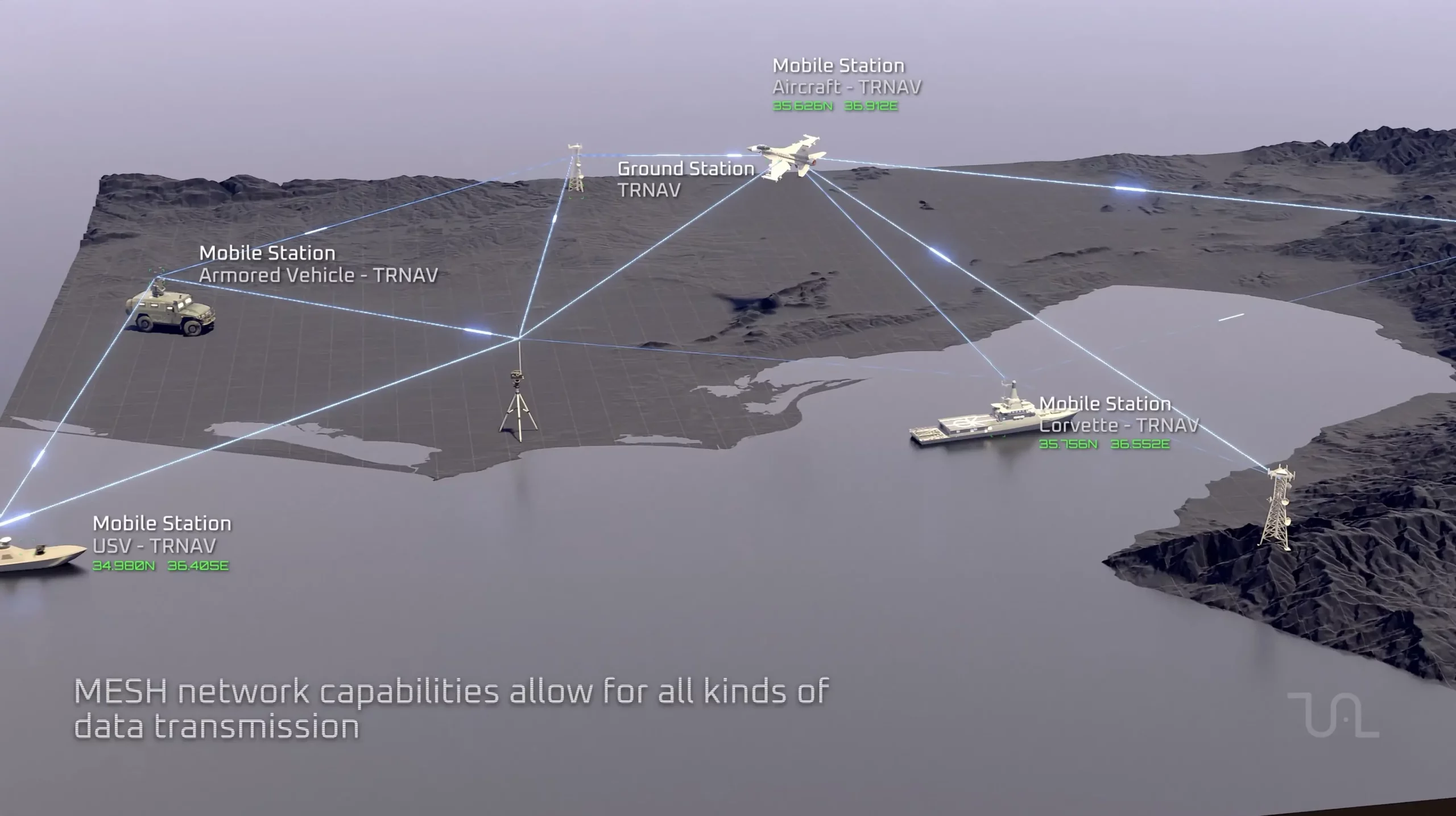
Field demonstration activities have revealed that the TRNAV system is capable of successfully navigating, especially in areas where GPS/GNSS access is unavailable or interfered with. TRNAV can be used independently or in a hybrid manner as an alternative navigation system in situations where GPS/GNSS is absent.
TUALCOM has developed high-capacity and wideband communication products offering communication options in L, S, and C bands through its innovative designs in the field of national data links. These products are designed to meet positioning requirements in environments without GPS/GNSS.
Measures Against Electronic Attacks
The increasing number of electronic attacks and jamming threats in recent years has increased interest in GNSS anti-jamming systems and enhanced the importance of GPS/GNSS independent navigation technologies. The TRNAV Terrestrial Navigation System Project was initiated to meet these requirements.
How does the TRNAV system calculate location?
The TRNAV system uses a network of multiple reference stations and native satellite signals to calculate position. This allows for more accurate positioning, independent of GPS/GNSS.
What are the components of the tRNAV system?
Reference Stations: Reference stations located at specific points throughout the country continuously collect location and time information. This information forms the basis of the TRNAV system.
Native Satellite Signals: TRNAV also receives signals from domestic satellites such as GÖKTÜRK and TÜRKSTSAT. These signals increase the accuracy and reliability of position calculations.
Algorithms: The TRNAV system uses advanced algorithms that process signals received from reference stations and domestic satellites. These algorithms can calculate the receiver's position and time with meter-level accuracy.
What are the differences between TRNAV and GPS/GNSS?
Localism and Nationalism: TRNAV is a system developed entirely with domestic resources. This provides a significant advantage in terms of national security and cyber defense.
Enhanced Sensitivity: It offers more accurate location and time information compared to GPS/GNSS.
Enhanced Reliability: It provides uninterrupted positioning services even when GPS/GNSS signals are weak or interrupted.
Data Link: TRNAV can act as a data link. This allows it to provide positioning services even in environments where GPS/GNSS access is unavailable or weak.
TRNAV Roadmap and Integration Studies
The TRNAV System, launched with the support of the Presidency of Defence Industries, has been established as a pilot application in various regions of Türkiye, and its expansion throughout the country is planned. Integration studies are ongoing for UAVs and UCAVs, as well as missile ammunition, naval vessels, manned/unmanned aerial vehicles, and land vehicles. The TRNAV system is considered to be able to successfully perform its duties in the Blue Homeland and cross-border applications.
Note
If you have any photos or video footage to support our news story, please share them with us using the information provided on our contact us page.
